For 48-753: Introduction to Urban Design Media
By Afshan Rehman
Using exploratory maps with 3 layers of terrain data Pittsburgh's slopy terrain is superimposed on city's contours, hydrology lines and flooding zones in the city. By studying the flow of contours, position of rivers, building footprints and easily flooded areas, we try to find out the relationship between flooding and landslides.
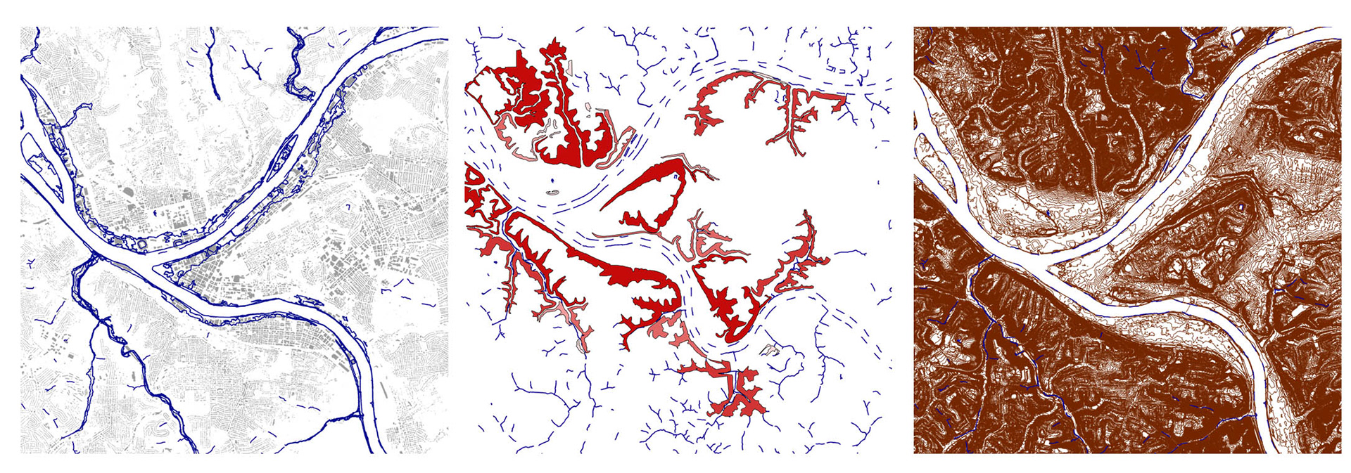
Terrain Mapping of Pittsburgh, PA
While studying the landslide prone areas in Pittsburgh, one particular site of interest is focussed on because of its scale. Located on the left side of Allegheny River, Monument Hill is 848 feet above sea level and has an area of 100,000 sq.ft. The vistas from the site have a panoramic view of the Heinz Field Stadium on one side and the downtown skyline on the other. The concrete roads fade into loose gravel where the hill contours down. Apart from the visible factors that may cause landslides, we examine the invisible factors through environmental Simulations.
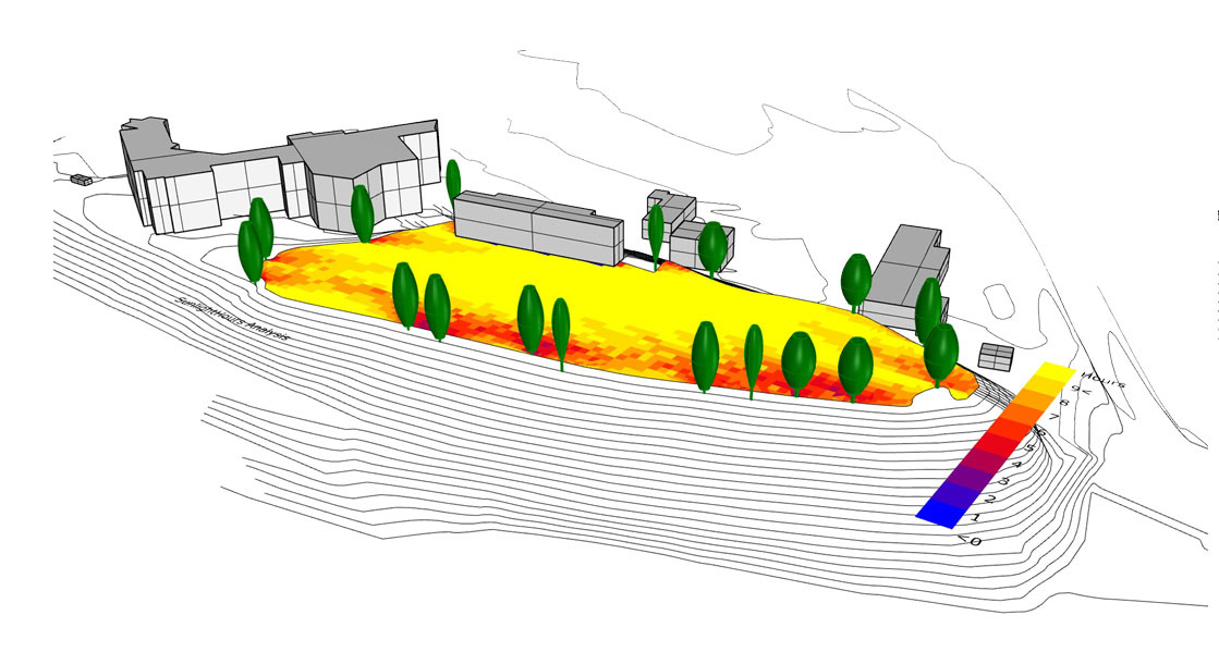
Sunlight Hour Analysis
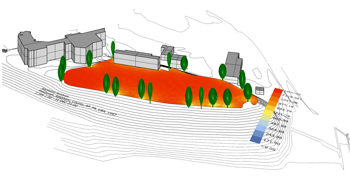
Radiation Analysis
Urban and rural development is increasing the number of landslides. To break the economic impact landslides have on urban development, we mark the footprint of built spaces along the hill, roads to understand the connectivity to its neighbourhood and contours to predict the movement of land. Lastly we draw an abstract picture where we scale the Monument Hill by 10 folds to emphasise the impact a probable landslide can cause.
Flip through the portfolio below to see more.